


ROLE
CONTEXT
PROCESS
TEAM
Infographics & research
These maps were developed as a part of an academic course called ‘Design Issues’. The goal of this project was to identify, analyse, and explore the elements of Syntax, Semantics, and Pragmatics, while mapping their interconnections and uncovering inference-related issues associated with the Tea routes. This project delves into the transformative impact of tea trade along its historical routes, highlighting the changes and innovations it brought across various sectors.
Looked at the brief history of tea routes and secondary research on trade routes for tea transportation.
The Tea Route was an ancient trade route which passed through Chinese provinces all the way to Tibet, and from these Tibet to other provinces. This route was crucial for passage and transfer of tea and some other commodities.
Despite being a topological feature, the Tea Route holds political, social and cultural layers.
3 verticals - the temporal, spatial and the artefacts which we delved into further.
The tea route was a collection of routes, rather than one route - which was used to transport tea and some other commodities across provinces, states and even continents.
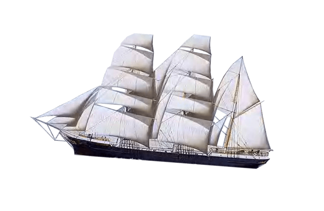
Tea was traded across 4 different routes, 3 via land and 1 via the Sea. Some prominent locations which are mentioned here, more will be covered in the spatial map.
Spatial mapping
Temporal mapping
Artefact mapping
Connecting the tea routes with Sustainability, Social Design & storytelling aspect of tea.
Deriving applications and design issues.
Nitya Vyas & Sohan Pujari
The Tea Route
Mapping tea route through spatial, temporal & artefacts.
RESEARCH | INFOGRAPHICS

Research
What is the Tea Route?
Mind map
Mapping
Connections
Design Issues

The visual style chosen for the mapping consiisted of various colonial painting potraied in a collage format to showcase the tea routes. The intention was to represent the diversity in the journey of tea trading through different painting and documentation styles.
The visual style chosen for the mapping consiisted of various colonial painting potraied in a collage format to showcase the tea routes. The intention was to represent the diversity in the journey of tea trading through different painting and documentation styles.
The colour palette was selected inspired from land and water which were the major trade route medium and accent colours to compliment the same.


b5e0f2
f5e2b9
ffdfab
e5c58b
Sky Blue
a5cc6b
ec9a29
8ec5d2
d85040
Wheat
Navajo white
Visual mood board
Spatial mapping
Sunset
Colour palette
ACCENT COLOURS
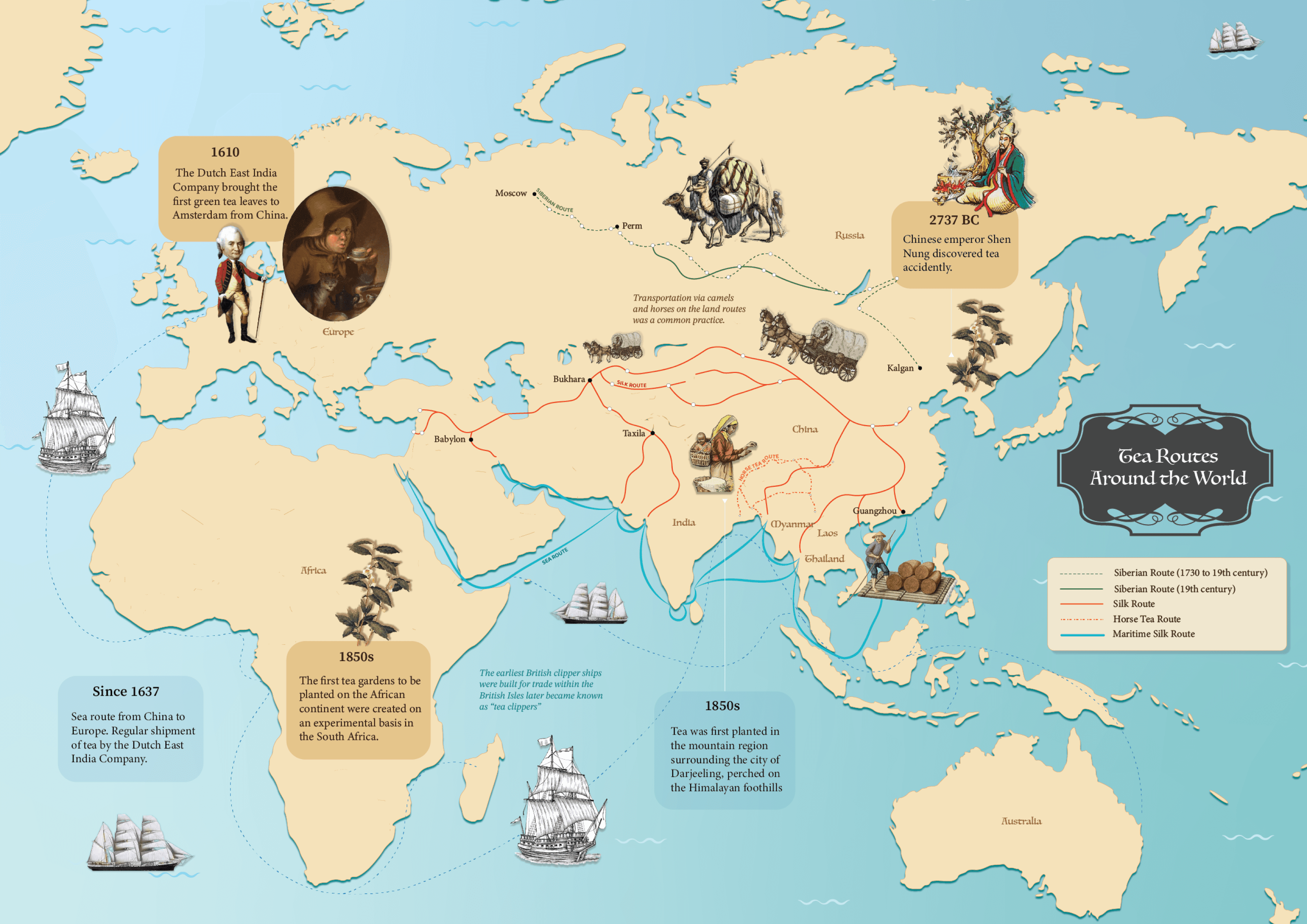
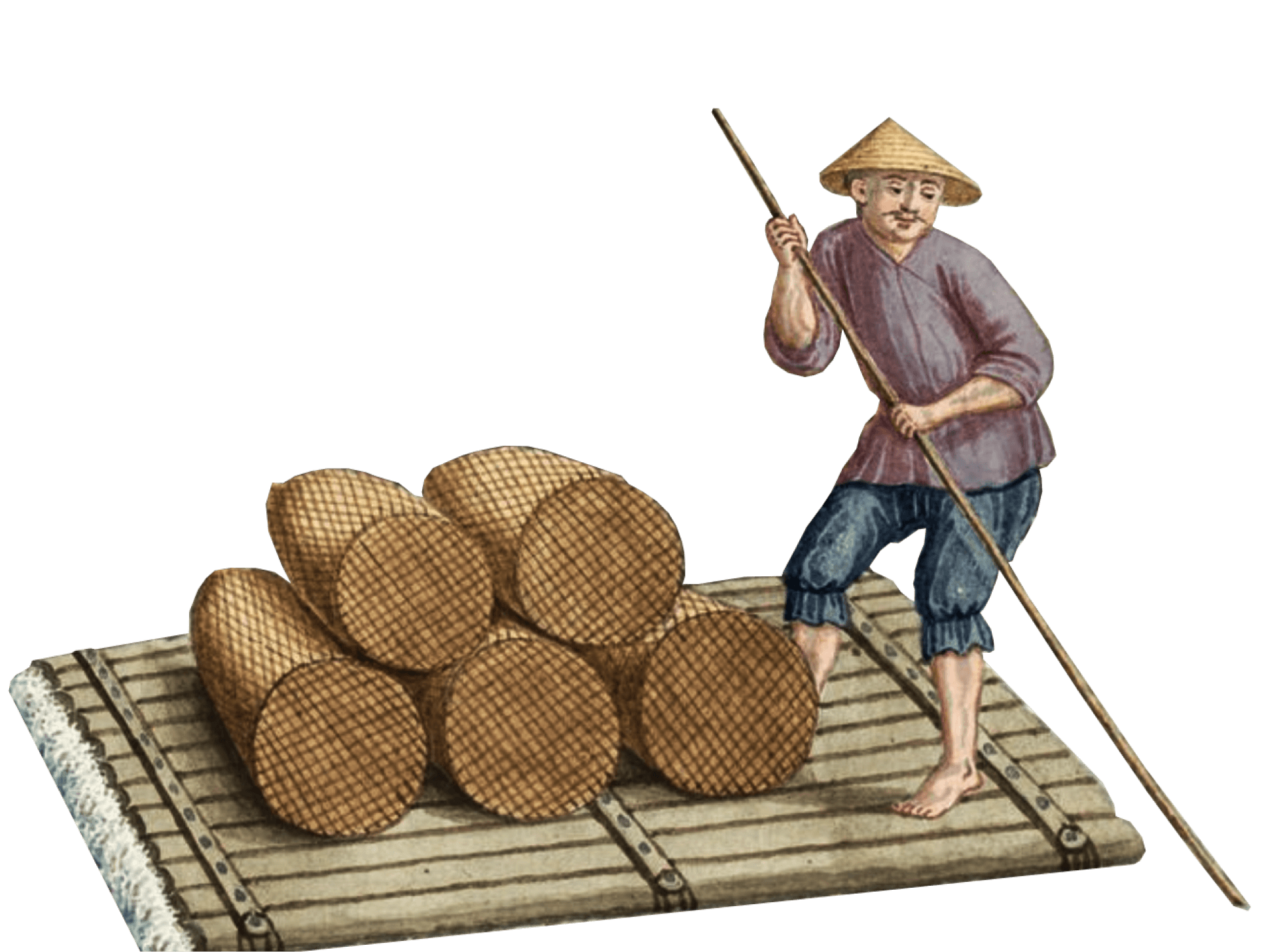
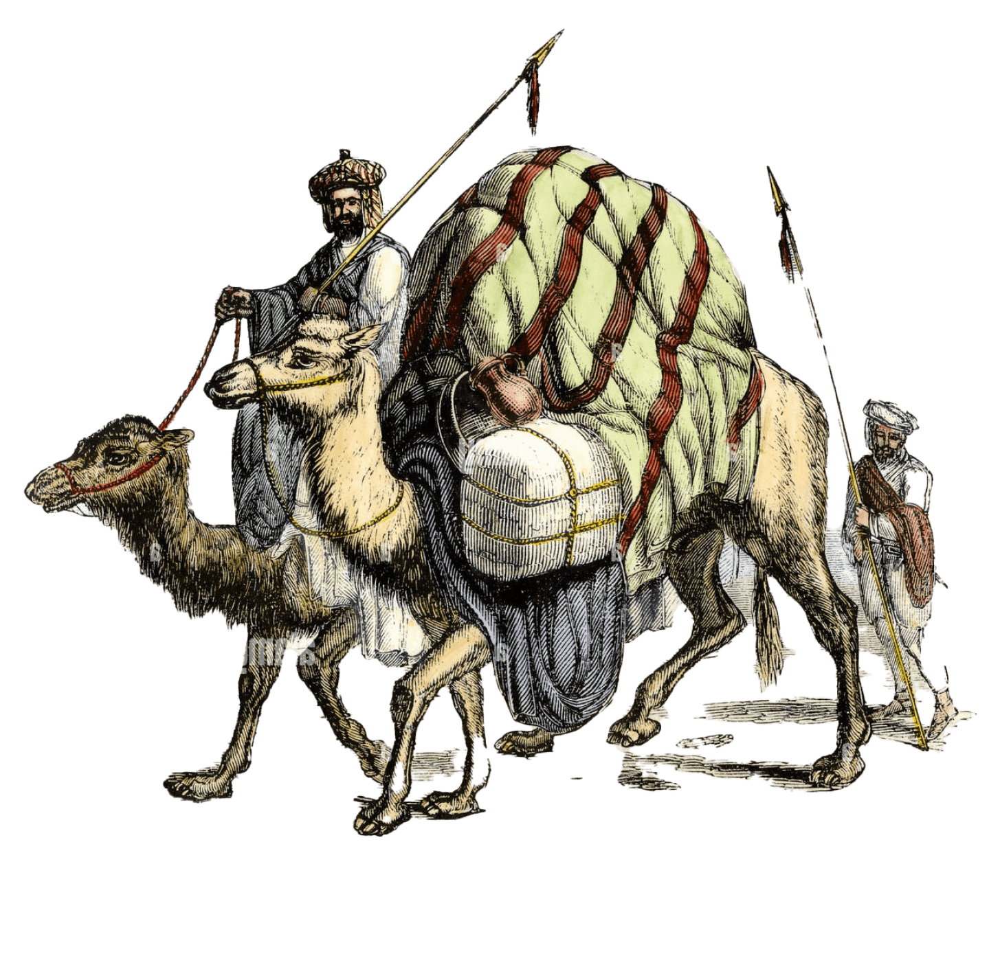
The spatial map displays the 4 different routes across which tea was traded. The first being the Horse Tea Road, which was used to transport Tea from China to Tibet. The Silk route was an important player in the transfer of spices, domestic goods and other trades - and tea was one of it’s most important component. Tea was often described as ‘currency’ at the time of the silk route - like spices.
The Siberian routes evolved in different centuries as a new path opened up (the dotted line and the bold line depict the two) - and these trade routes passed through Russia.
The fourth route was a sea route, it was the maritime silk route where again, tea was traded along with spices and transported to the farther off continents and to the west. The landing province, which later became a point of convergence for the west and the Chinese dynasty’s tea trade was used to set up transfer and give the foreigners tea to take with them to ports.
As time passed, with developments in tea processing, transport and as a result it’s demand, the travellers on the road increased, the no. of routes increased.
This sort of an interdependence of tea culture over trade and the evolution of the routes and it’s deepening connections are visible in this temporal map.
The trade hence, encapsulated the entire globe, despite having close to no resources that we have at this day and age.
If we compare and contrast the routes of present day ‘tea routes’ - they’ve been reopened to tourists, with a lot of additions and changes, but they retain the leftover marks of a distant past.
Temporal mapping
Artefact mapping
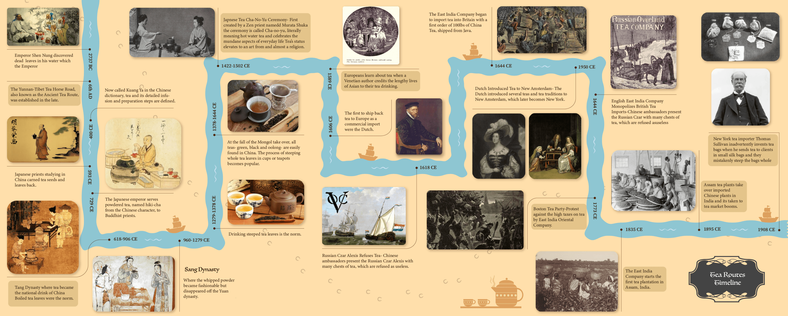

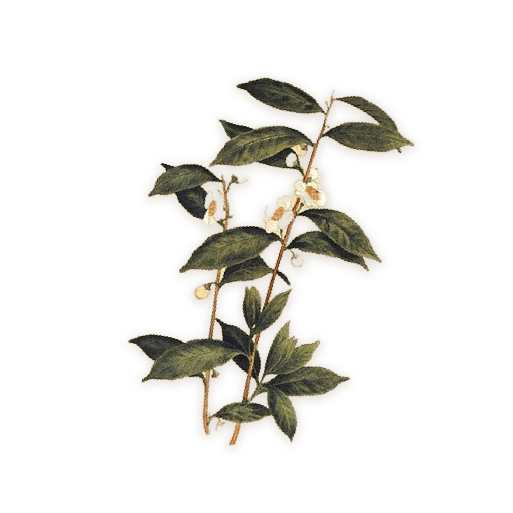
As was visible in the temporal map, there are common pieces starting to appear between the maps and research - which are the artefacts. These give an insight into not only the route travelled, but also the era/time they belonged to.
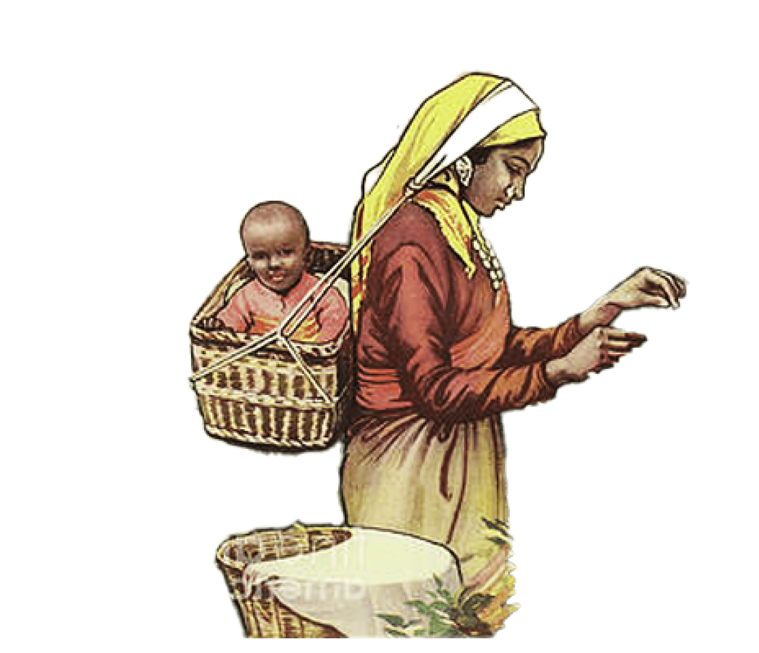
The different types of chests found from the time of the tea trade indicated the ‘kind’ of transport used - that is, the packaging was the clue to how tea was being transported, and to where. Tea shaped into bricks was carried over long distances by human porters while lose tea leaves and some varieties of green tea were shipped in cartons or boxes.
Important artefacts found included the pots used for tea storage and some hundreds to thousands of years old dry tea samples.

Conceptual map
We were able to look at how there are two types of sustainability, one of resources and one of society and culture, and as soon as you look at societal and cultural sustainability - a direct connection with social design can be formed.
‘Misdesigning’ becomes intolerable - when we bring in social design, because any and every design that ignores it’s environmental and societal impacts - starts being called ‘misdesign’.
- Victor Papnek

Sources for all the images and information used can be found here.

Made with love and framer in Mumbai, India.
For opportunities or simply to chat, write to me at
deekshaanim24@gmail.com
Home
About
Work
Contact